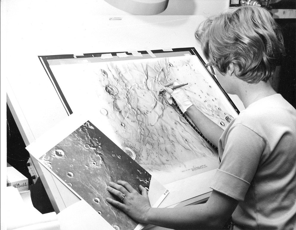
Image: Primary lunar map illustrator Patricia Bridges at work.
On October 4, 1957 the world looked up to the skies, skies that would never be the same again. It was on this fateful fall evening that the Soviet Union launched a beach ball-sized metal sphere into space. By today’s standards of space exploration, with the wide variety of uncrewed and crewed spacecraft exploring the heavens, this 184-pound orb may seem trivial. But it stands out because it was the first artificial satellite. It is the vehicle that set our species on a course to explore firsthand the final frontier, and the siren call for the United States to catch up to the Russians in the newly minted space race. This manifested itself in a call-to-action that eventually resulted in humans taking the first step on another world in 1969, an audacious effort that saw Lowell play an important role.

Three years after that first satellite, Sputnik 1, broke the bounds of space, a man from St. Louis named William Cannell visited the United States Naval Observatory’s Flagstaff Station (NOFS) to gaze at the Moon through one of the facility’s telescopes. Cannell was a cartographer working for the Aeronautical Research and Information Center (ACIC), a branch of the U.S. Air Force then creating lunar charts. He was on a mission to find a telescope for carrying out a sustained Moon mapping effort in support of eventual human travel to the lunar surface. He learned from NOFS director Art Hoag that all the telescopes under his control were already in regular use. Hoag did prove quite helpful, however, advising Cannell to talk with John Hall, director of nearby Lowell Observatory, to see if Lowell might have a telescope available for such a project.
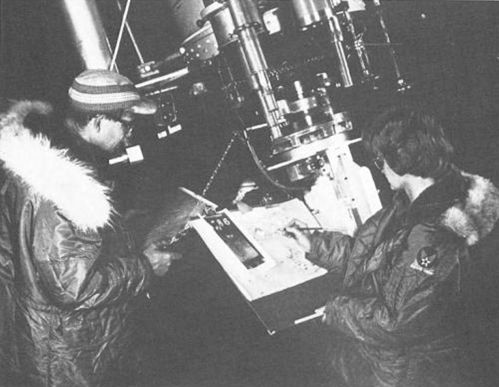
Cannell approached Hall, who was very happy to offer the 24-inch Clark Refractor, ideal for the observations and also available for use. Throughout the following year, Cannell and occasionally an assistant or two would visit Lowell a few days a month to make observations. In the late summer of 1961, the Moon mapping effort at Lowell escalated when the ACIC opened an office at the observatory, ushering in an eight-year period during which telescope observers, photographers, and scientific illustrators focused their energies on creating dozens of maps of the Moon.
Cannell managed the office and for the first several years a talented young artist, Patricia Bridges, served as the primary illustrator, using an airbrush to record artistic yet accurate renderings of mountains, craters, valleys, and other features of the moon. The airbrush technique resulted in maps rich in detail and character. Telescope observers would make primary observations through the Clark and then Bridges used these basic drawings, supplemented by lunar photographs and her own observations through the Clark, to craft her maps.
The ACIC effort expanded during its time at Lowell, adding another telescope (in the dome that stills sits just to the northeast of Lowell Observatory’s visitor parking lot), enlarged office space, and a motion picture camera for supplementing the visual observations through the telescope.
Bridges eventually left the ACIC office to raise her kids, opening the door for another talented illustrator, Jay Inge, to take her place. Inge continued on through the end of the program in 1969 and played a key role in developing the last product of Lowell’s ACIC office, a spectacular 16-inch-diameter lunar globe that surpassed all previous ones in details and accuracy.

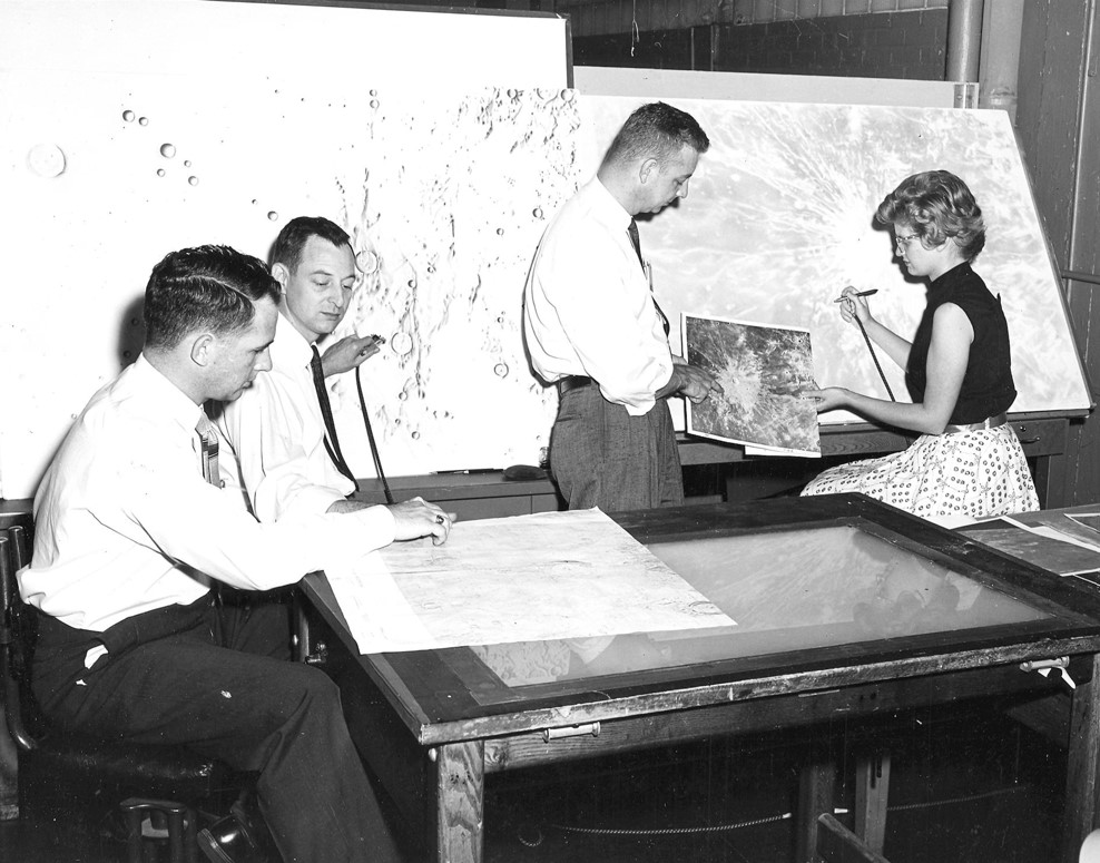
All told, the ACIC staff created dozens of lunar charts, most based on telescope observations but some from data collected by Ranger, Lunar Orbiter and Surveyor spacecraft. These maps were critical to understanding the nature of the lunar surface.
While the cartographers prepared these charts at Lowell, the astronauts themselves came to Flagstaff as part of their training. They studied the geology of Meteor Crater, the Grand Canyon, and various cinder fields while practicing many aspects of their missions. The first group of astronauts to train in northern Arizona—the so-called Next Nine, which included the likes of Neil Armstrong, Jim Lovell, Frank Borman, and others—also visited Lowell Observatory on a winter day in 1963 to learn mapping techniques from the Moon mapping team.
This mapping effort was the last sustained research program carried out with the Clark, though some smaller-scale projects continued for several years. Today, evidence of the Moon work done at Lowell during those heady days of Apollo is sparse. The illustrators, observers, and photographers have long since retired and the detailed charts they created are neatly stored for posterity. The section of the ACIC office not torn down years ago has been completely renovated and now houses the observatory’s business staff, all signs of its former use gone. The one exception is the Clark; today, Lowell staff continues to point it at the Moon each month, affording visitors an opportunity to follow in the footsteps of the astronauts and Moon mappers alike while exploring the universe for themselves.